Improvement in GEO:
UI Design Standardization for GEO MAPID
In this latest update, GEO MAPID has carried out a comprehensive user interface design update to enhance consistency and user experience across the entire platform.
The layer card display now comes with a clean and modern black-and-white theme, providing a minimalist and visually comfortable appearance.
In addition, the card design has been refined to be more neat and structured, making it easier for users to navigate and manage projects more efficiently.
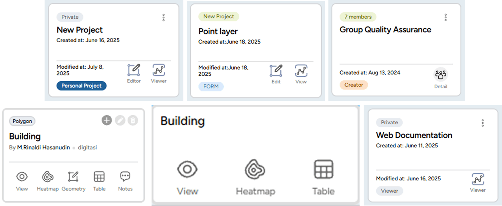
1. Project Card Display Update
Displays pinned projects with role information (Personal Project, Creator, Admin, Contributor, Viewer) along with project information (Private / Public).
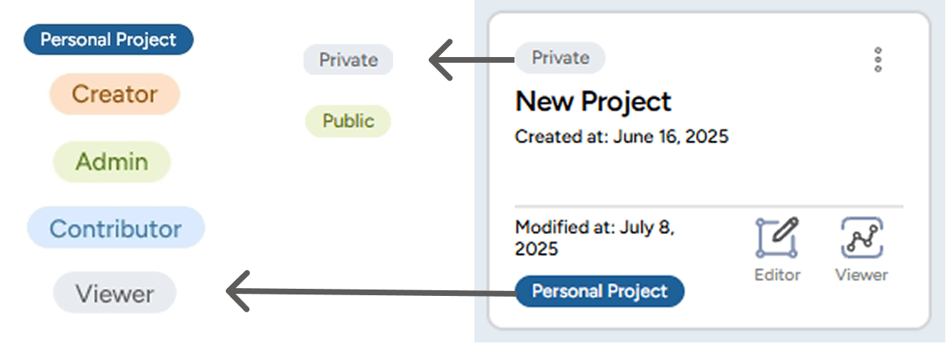
Each project status is now equipped with specific colors to help users easily distinguish the purpose and access rights of each role within the project.

- A project created specifically by the user for personal use.
- Other members in the Collaboration group cannot access or view this project.

- Status assigned to the user who created the project.
- Initially, the project is a Personal Project, but when shared to a Group, its status changes to Creator.

- Status assigned by the Creator to other members to manage all activities within the project, such as editing, managing data layers, and inviting members.
- Does not have the right to delete the project.

- Status assigned by the Creator or Admin to members to contribute to the project, including creating and adding data layers.

- Status assigned by the Creator or Admin to members to only view the contents of the project without being able to make any changes.
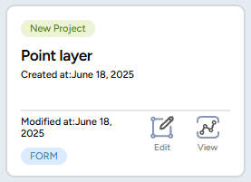
2. Form Card Display Update
- The Form display has been improved to be cleaner and simpler, making it easier for users to create new Forms and search for the Forms they need without having to enter a project first.
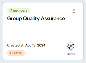
3. Group Card Display Update
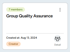
- The group card display is now more informative, showing pinned groups along with role information (Personal Project, Creator, Admin, Contributor, Viewer) more clearly using color indicators.
- A “Detail” button has been added to make it easier for users to view and manage the member list within each group.
4. Map Editor Layer Card Display Update
- The layer card filter feature has been simplified, making it easier for users to quickly search for layers by name and type.
- The icons and information on each layer card have been redesigned to be more minimalist and structured, enhancing the user experience when managing data layers.
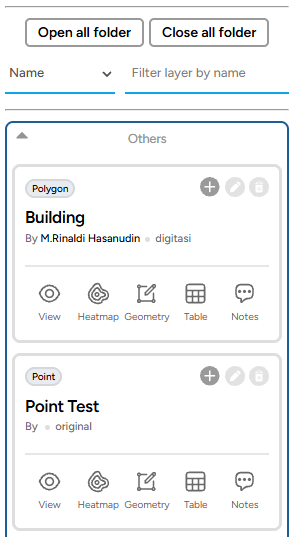
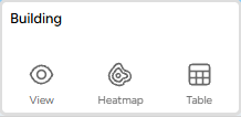
5. Layer Viewer Card Display Update
- The layer card design now features a minimalist black and white theme, giving it a cleaner and more modern appearance.
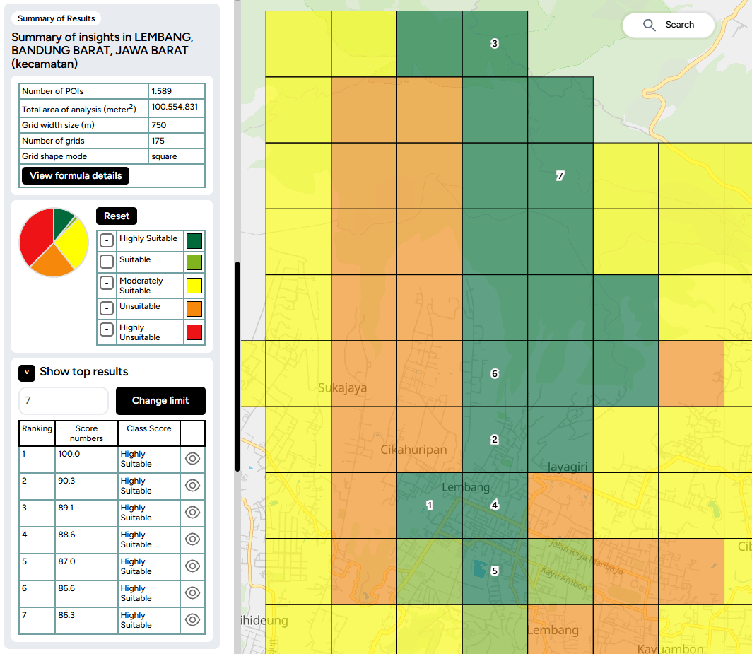
6. Addition of Top Results Feature in Insight
- Insight is now equipped with a Top Results feature that displays the best locations based on their scores.
- Users can set the number of top results to be displayed by adjusting the range in the input field.
- Each top location will be marked with a ranking number directly on the map grid, making it easier to identify and analyze areas with the highest scores.
- This feature helps users to make quick decisions in selecting the optimal location according to their analysis needs.
7. Group Collaboration with Collaborator License
Users can now invite members into collaboration groups according to the number of collaborators included in their purchased license. Invited members will have admin-like access and can explore the entire GEO platform.
- After purchasing the license along with the collaborator quota, users can access this feature via the Collaboration button in the left sidebar.
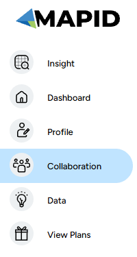
- The Group Collaboration Management menu will appear, allowing users to manage registered collaboration members.

- Admins can create a new group by clicking the “Create New Group” button.

- After creating a group, click “Detail” to register collaboration members into the group.
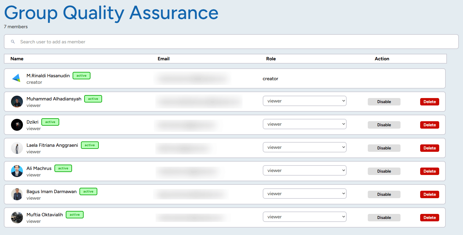
- Important note: Members who can be invited to the group are those who have already been registered as Collaboration Members.
8. Improved Visualization of Points and Area Boundaries in SINI
In the latest SINI update, visual enhancements have been implemented to improve data clarity on the map:
- Location points are now displayed larger and with higher contrast, making it easier for users to view point distributions on the map.
- Point colors have been updated to stand out more clearly above the map layers, assisting with quick data identification.
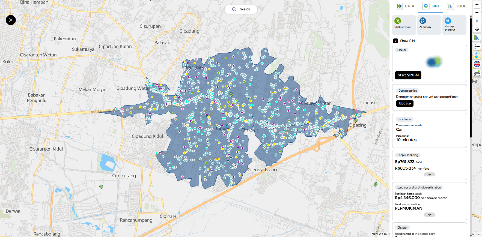
- Area boundary lines have been enhanced with bolder colors, allowing areas and analysis zones to be distinguished more easily on the map display.
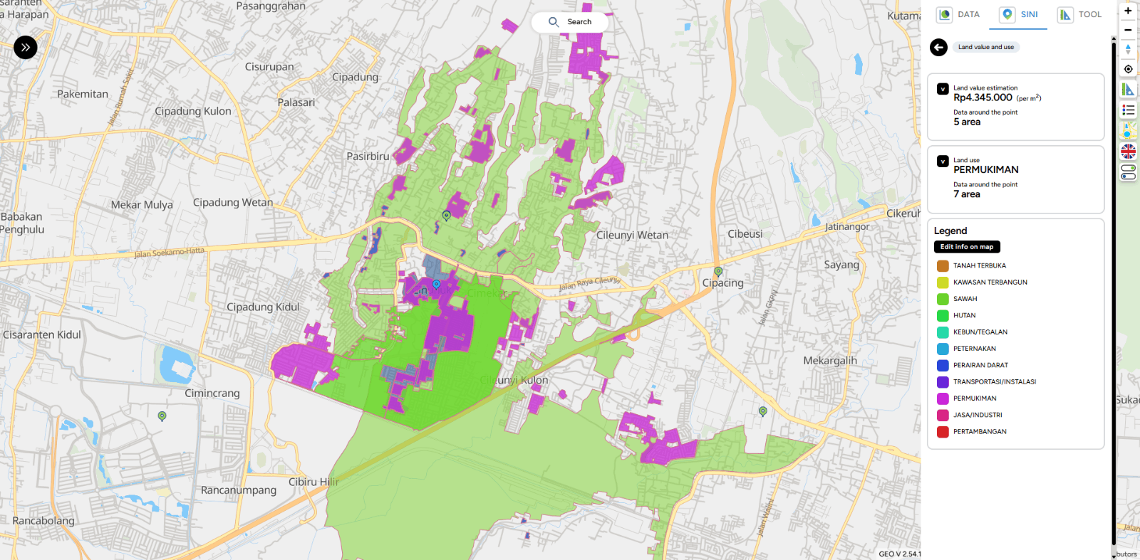
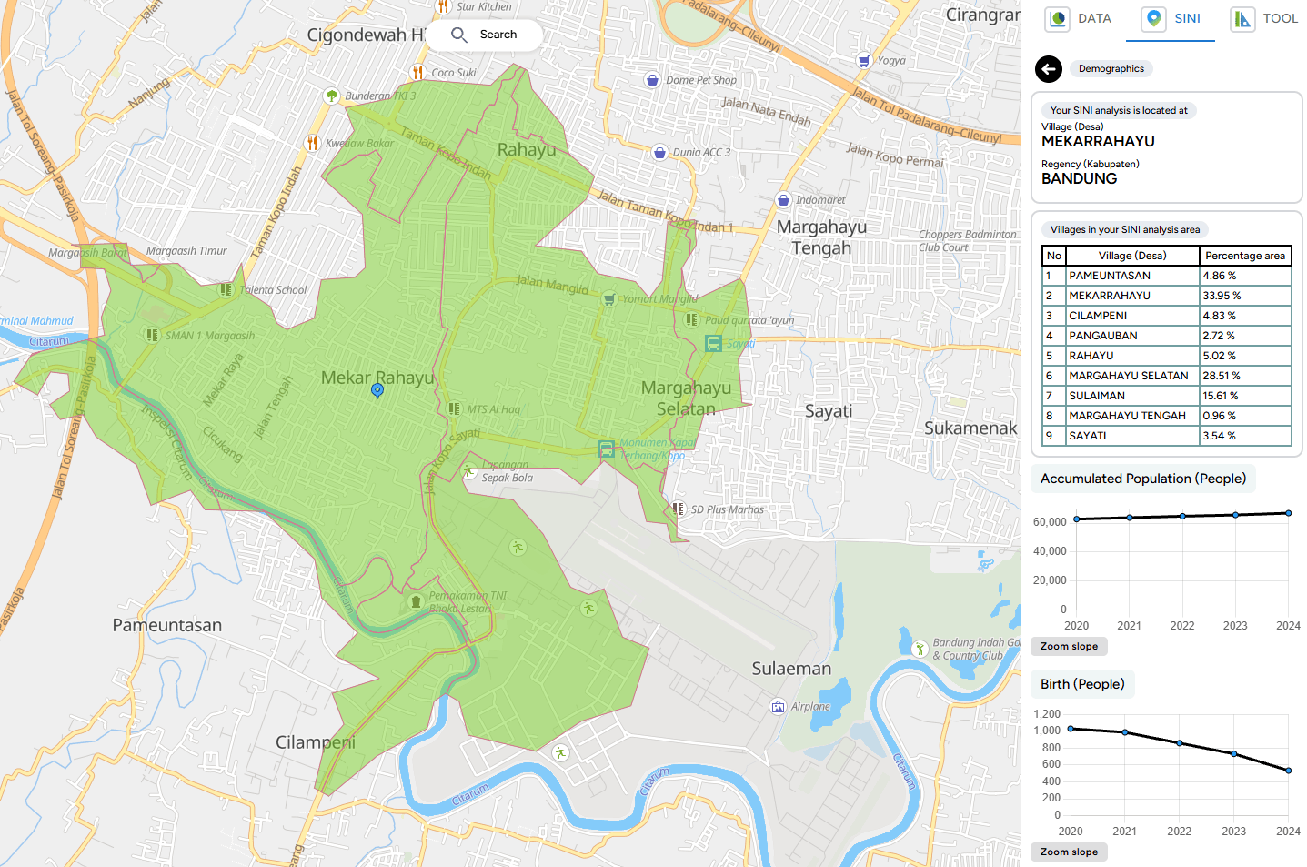
- In this latest update, SINI provides more detailed and comprehensive demographic data to support users' analytical needs.
9. Proportional Demographic Data Update
SINI is now equipped with a proportional demographic data update feature, which allows users to:
- Update demographic data when the existing data is outdated.
- Utilize more accurate and relevant demographic data for location analysis and decision-making.
Bug Fixing
1. Import Data Editor
- Fixed: Data filter in Import Data Premium did not display correctly when users clicked on a catalog and searched within the data column.
- Fixed: Import Data search feature not displaying results properly.
- Fixed: Import Data Map Editor issue where searching data immediately showed “no results” even while data was still loading.
- Fixed: Background on Data Premium catalog not appearing when clicked.
- Fixed: User imported data in Import Data Map Editor not appearing even though results were displayed.
2. Excel Data Export
- Fixed: The order of data in downloaded Excel files which previously showed data sorted from bottom to top, now displays from the beginning.
3. Business Intelligence
- Fixed: Data type validation from text to number/currency on BI Card in Group Text & Calculate Other Columns mode.
4. Map
- Fixed: Outline on LineString not appearing.
- Fixed: Bug in Digitization Pointing / SINI / All Toolbox where the (+) icon was not displayed.
5. Map Popup
- Fixed: Geo link in layer popup resulting in “undefined”.
- Fixed: Popup on LineString not appearing.
6. New Column & Edit Column Popup
- Fixed: Save Feature button on Edit and New Column in Table Editor was unclickable.
7. Table Editor Columns
- Changed Calculate Dimension property type to number.
- Removed M / KM / Mile labels from calculate dimension and now automatically display them in the title.
- Standardized decimal and comma notation in calculate dimension to match number data type formatting.
- Fixed: When a table cell was double-clicked and switched to another cell, it saved “0”; however, deleting the “0” did not save the empty value.
8. Insight
- Fixed: Top Result Insight rating numbers display.
9. SINI
- Fixed: POI errors in SINI.
10. WhatsApp Admin
- Fixed: WhatsApp chat requests to Admin not appearing.
11. MAPID Form
- Added: Notification when no response is received from generate results on: Sub-district (Kelurahan), District (Kecamatan), City, Province, Nearest Address, Nearest Building.
- Fixed: Template input that remained visible in the form column even after being deleted.
- Fixed: Date and Time styling box overlapping on iOS mobile browsers.
12. Publication
- Fixed: Draft article publication not being saved.
13. Dashboard
- Fixed: List type status on the dashboard is now properly differentiated.
- Fixed: Collaborators with Viewer status were able to open the Editor when using card mode on the dashboard.
